
Reykjavík sits in one of the most accessible hiking landscapes in the world. Within an hour of the city, you can summit a 914-meter mountain with views across the entire capital area, soak in a natural hot spring river reached by a 3 km trail, or hike to Iceland's second-tallest waterfall through a fjord barely anyone visits. These are not beginner introductions to the outdoors. They are three of the best hikes in the country, and they all start less than an hour's drive from downtown.
Hike 1: Mount Esja, The Iconic Mountain Above Reykjavík
- Distance: 8 km round trip to Steinn, 10 km to summit
- Elevation gain: 780 meters to Steinn, 914 meters to summit
- Difficulty: Moderate to challenging
- Time: 2.5 to 4 hours depending on destination
- Drive from Reykjavík: 25 minutes north on Route 1
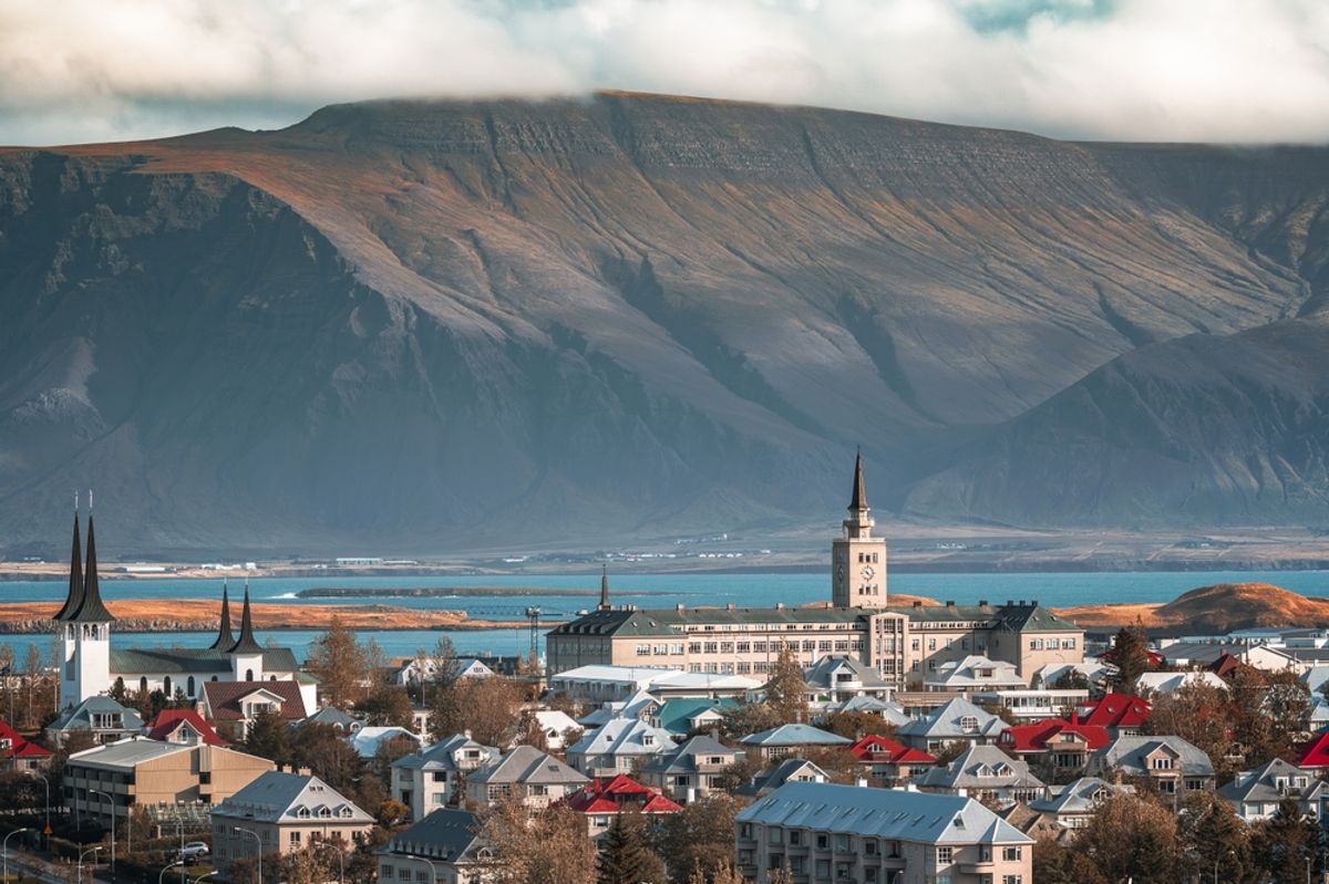
Mount Esja is the long, flat-topped mountain that forms the northern horizon of Reykjavík and is visible from almost everywhere in the city. For locals, hiking Esja is not a tourist activity. It is what you do on a Sunday morning. For visitors, it is the best single hike accessible from the city, a genuine mountain ascent with the full capital visible from the top.
The trail starts at Esjustofa, a small hiking center with a parking lot and a basic cafe. From here, the path winds upward through grassy slopes before transitioning into rockier volcanic terrain. The trail is well-marked throughout and graded with boot icons: one boot for easy sections, two for moderate, three for the upper challenging sections.
Most hikers aim for Steinn, a large boulder marked with the word STEINN that sits at roughly 780 meters. The views from here over Reykjavík, the harbor, Faxaflói Bay, and the mountains across the water are already spectacular. For most casual visitors, this is the right turnaround point.
From Steinn, the route to the summit of Þverfellshorn at 914 meters involves steeper, rockier ground and one section with a fixed chain to assist with the scramble. The terrain becomes genuinely exposed in wind, which on Esja is not uncommon. The summit is best attempted in summer by hikers with experience on rocky mountain terrain.
On a clear day from the top, you can see south to the Reykjanes Peninsula, east to the highlands, west across Faxaflói Bay to the Snæfellsjökull glacier on the Snæfellsnes Peninsula, and straight down to the city spread below you.
Hike 2: Reykjadalur Hot Spring River, Where the Hike Ends in a Bath
- Distance: 6 km round trip
- Elevation gain: 200 meters
- Difficulty: Easy to moderate
- Time: 2 to 3 hours including bathing
- Drive from Reykjavík: 45 minutes southeast via Route 1 to Hveragerði
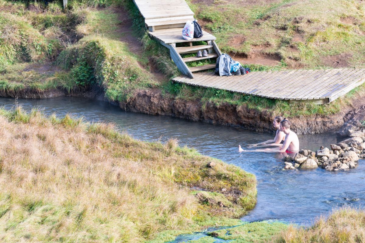
Reykjadalur, which translates as Steam Valley, is a geothermally active river valley behind the town of Hveragerði. The trail is 3 km each way, gaining 200 meters in elevation through a landscape of steam vents, bubbling mud pools, and hot springs. At the top of the valley, a river runs at bathing temperature.
The first part of the trail passes through open farmland, then enters the geothermal valley where steam rises from the hillsides on both sides and the smell of sulphur announces what is ahead. The path is clear and well-maintained but becomes muddy after rain. There are wooden boardwalks over the most delicate sections.
At the bathing river, the water temperature varies along its length: hotter where hot springs feed directly into it, cooler downstream where the river mixes with cold water. Walk along the bank to find the temperature that suits you. There are no facilities at the river. No changing rooms, no lockers, no cafe. Change at the riverbank, leave your bags on the bank, and wade in.
The experience of lying in a geothermally heated river in a steam-filled valley with the surrounding hills venting from below is entirely specific to Iceland. No infrastructure mediates between you and the landscape. On a clear winter day with frost on the ground and steam rising in every direction, it is one of the most memorable outdoor experiences in the country.
Hike 3: Glymur Waterfall, Iceland's Second Tallest and Hardly Visited
- Distance: 7 km round trip
- Elevation gain: 420 meters
- Difficulty: Moderate to challenging
- Time: 3 to 4 hours
- Drive from Reykjavík: 50 minutes northwest toward Hvalfjörður
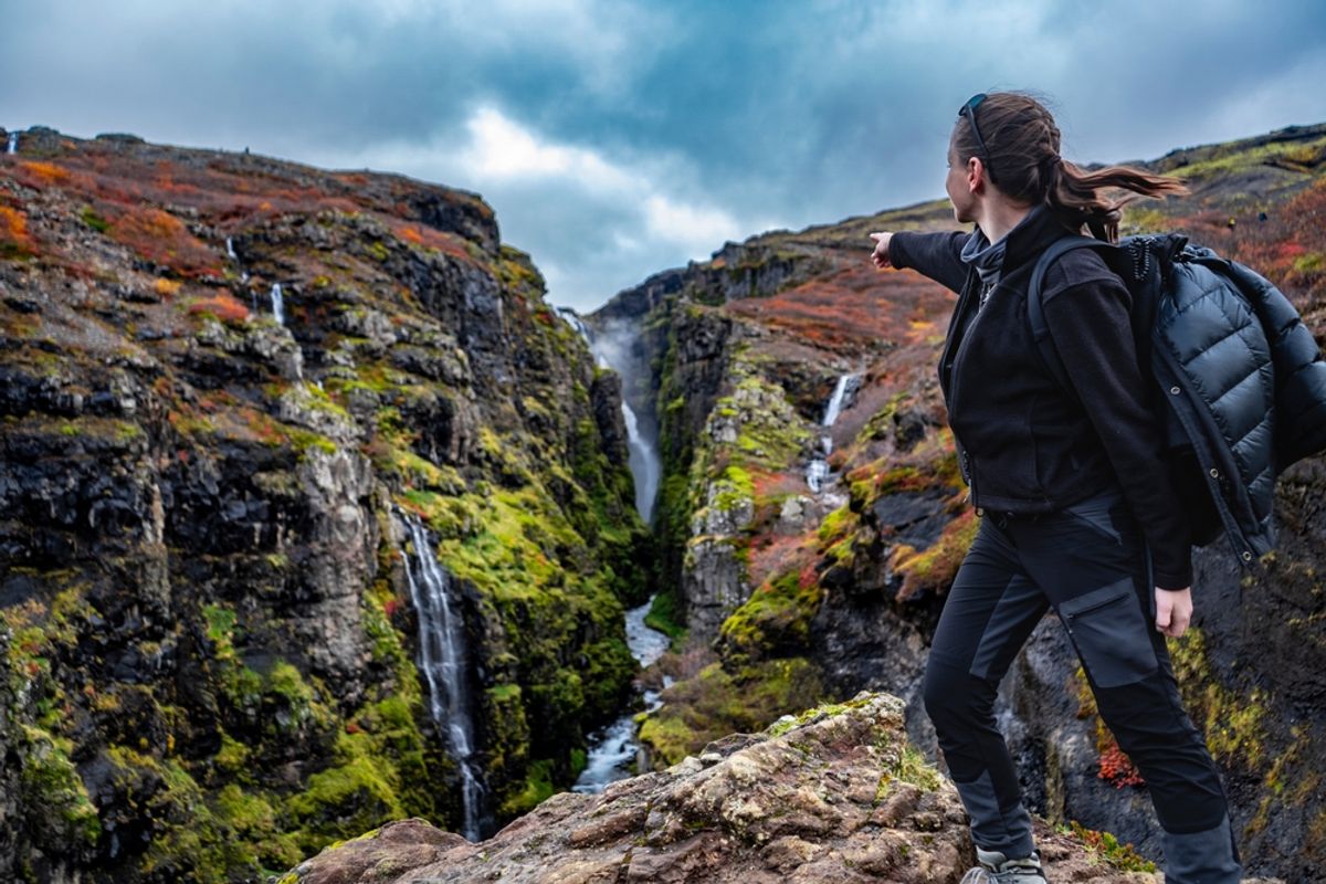
Glymur drops 198 meters into the Hvalá canyon near the end of Hvalfjörður fjord, making it Iceland's second-tallest waterfall. The drive there takes you through the longest tunnel in Iceland, emerging into a fjord that most visitors skip entirely. The hike to Glymur is consequently one of the least crowded remarkable experiences near Reykjavik.
The trail begins at the end of the fjord road and immediately involves a crossing of the Botnsá River. In summer, a log is typically placed for crossing. In high water or winter conditions, this crossing becomes the main difficulty. After the river crossing, the path climbs into the canyon, passing through a short cave section before emerging on the cliff path above the gorge.
The upper trail runs along the canyon rim with views down into the narrow gorge and eventually out to the waterfall itself. The falls drop in a single unbroken column into the canyon below, and the spray is visible from the cliff path. On sunny days, rainbows form in the mist.
The complete loop crosses the river twice, once low and once on a log bridge higher up, and loops back to the trailhead from the opposite side of the canyon. This gives two different perspectives on the waterfall and makes the return more interesting than retracing the ascent.
Practical Tips for All Three Hikes
Check the weather before departing. Iceland's weather changes within the hour. The Veður app from the Icelandic Met Office gives reliable forecasts. A clear morning can become a cold, wet afternoon. Carry waterproof gear on every hike regardless of the forecast.
Wear the right footwear. Waterproof boots with ankle support and grip soles are appropriate for all three hikes. Trail running shoes work on Esja in summer. On the rocky upper sections of Esja and the canyon path at Glymur, ankle support makes a material difference.
Layer up. Even in summer, wind at elevation is cold. The summit of Esja is exposed in every direction. Carry a warm mid-layer and a windproof outer shell regardless of the temperature in the city below.
Download an offline map. Mobile signal is unreliable on Esja above Steinn and inside the Reykjadalur valley. Download the relevant AllTrails or Komoot map before leaving the city.
Register longer hikes at safetravel.is. Iceland's official hiking safety site allows you to register your route and expected return time. Standard practice for any hike above easy difficulty.
Ready to Experience the Golden Circle?
Book your tour today and see these incredible sights with an expert local guide.
View Our Tours

