
The Kerið Crater hike is one of the most unique and easy outdoor experiences in Iceland. Unlike many volcano craters that are difficult to reach or require serious hiking skills, Kerið is completely accessible to most visitors. You can walk the full rim and descend to the lake in under an hour, making it a perfect stop whether you are on a Golden Circle tour or exploring Iceland's South at your own pace.
This guide covers everything you need to know before you go — the trail, the distance, what you will actually see, and how to plan your visit the right way.
Kerið Crater Trail Overview
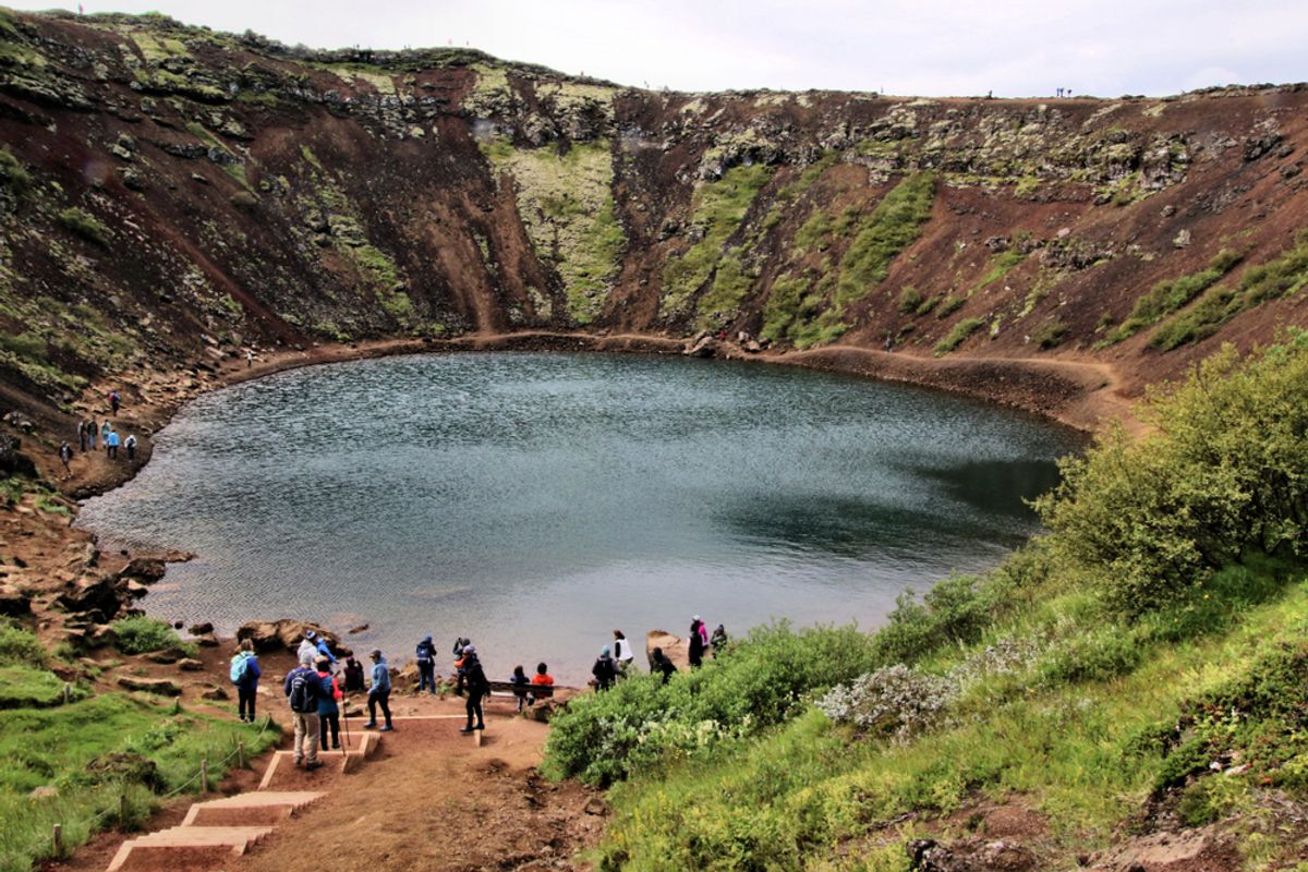
The trail at Kerið consists of two parts: the rim path that circles the top of the crater, and a separate path that descends down to the lake shore. Both are marked and well-maintained.
Rim Trail
The rim trail loops around the entire edge of the crater. It is approximately 1 kilometer in total length. The path is mostly flat but has some uneven gravel sections, especially on the far side from the parking lot. Walking the full rim gives you a 360-degree view into the crater and out over the surrounding Icelandic countryside.
The south-facing rim tends to get the best light for photos in the afternoon. The north side gives you a higher vantage point looking across to the other rim.
Path Down to the Lake
A separate path leads from the rim down to the lake at the bottom. This descent is around 55 meters and takes about 5 to 10 minutes each way. The path is steep in sections but has steps and gravel to help with footing.
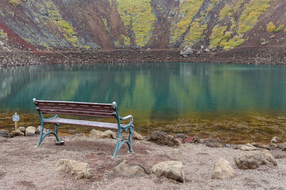
The lake itself is shallow, and you can walk right to the water's edge. The color of the water shifts depending on algae levels and lighting, ranging from pale turquoise to deep green.
Kerið Crater Hike Distance and Time
The total hiking distance at Kerið is short. Most visitors complete the entire experience, including the rim loop and the descent to the lake, in 30 to 45 minutes. If you take your time for photos and soak in the views, plan for about an hour.
- Rim loop distance: approximately 1 km
- Descent to the lake and back: approximately 0.4 km
- Total hiking time: 30 to 60 minutes
- Difficulty level: Easy to moderate
The trail is suitable for most ages and fitness levels. Children can do it comfortably. The descent to the lake requires a bit more care, particularly if the ground is wet.
What to Expect on the Kerið Crater Hike
The Terrain and Footing
The rim path is mostly packed gravel with some rocky patches. Wear sturdy shoes or trail runners at a minimum. Regular sneakers work fine in dry conditions, but after rain, the path can become slippery, especially on the descent. The volcanic rock is sharp, so watch your step if you step off the trail.
The Views
From the rim, you get an unobstructed view down into the crater. The color of the walls — deep red, orange, and black — looks especially vivid in morning or late afternoon light.
From the opposite rim, you can see across the Grímsnes area, a flat volcanic landscape scattered with farms and smaller lava formations. The view down to the lake is the highlight, particularly if the water is calm and reflecting the sky.
The Lake at the Bottom
The lake is fed by groundwater rather than precipitation, which keeps it at a fairly consistent level year-round. The water level is only about 7 to 14 meters deep, which is surprisingly shallow given the depth of the crater itself. Swimming is not permitted. Standing at the water's edge with the red crater walls rising around you is genuinely impressive and worth the short descent.
Kerið gets busy during peak summer months, especially between 10 am and 3 pm when most Golden Circle tours pass through. If you visit early in the morning or in the evening during summer when daylight extends past midnight, you can have the crater nearly to yourself. Spring and autumn visits tend to be quieter and the lower angle of light makes the crater colors even richer.
Ready to Experience the Golden Circle?
Book your tour today and see these incredible sights with an expert local guide.
View Our Tours

