
How Was Kerid Crater Formed?
By collapse rather than explosion. The prevailing explanation is that a scoria cone erupted here, and when the small magma chamber beneath it emptied towards the end of the eruption, the roof of the chamber had nothing left to rest on and dropped.
That leaves a steep-sided bowl with the cone's own red material lining the walls, which is exactly what you see from the rim.
Kerið is roughly 6,500 years old according to the official Kerið site, which makes it young enough that the shape has barely weathered.
Collapse or Explosion?
The distinction matters because it explains why Kerið looks different from other craters.
An explosion crater is blown outward, and it usually leaves a ring of ejected debris around it with a shallow bowl in the middle.
A collapse caldera is dropped inward. The walls are steep, the floor is flat, and there is no significant debris ring, because nothing was thrown anywhere.
Kerið has steep walls, a flat floor and no ejecta ring. It is also oval rather than circular, which suits a chamber roof failing along a line rather than a single point of eruption.
An older explanation held that Kerið was a single explosive crater. The collapse account is the one that fits the shape, and it is what the site's own material describes.
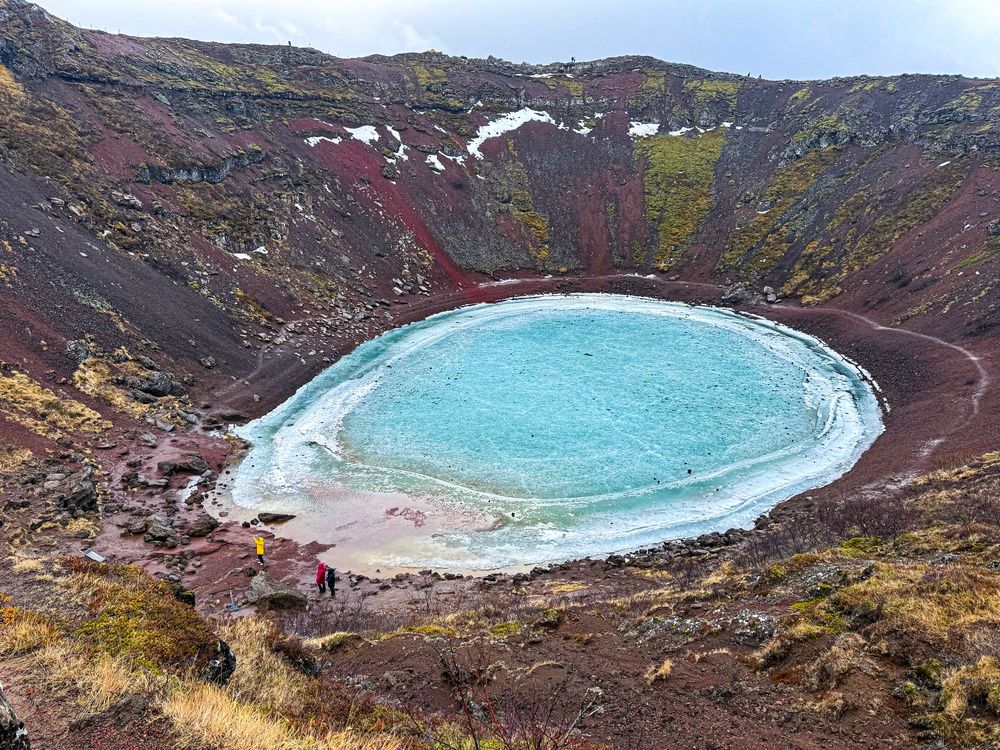
The Tjarnarholar Crater Row
Kerið is not a one-off, which is the thing most visitors miss entirely.
It sits at the northern end of the Tjarnarhólar row, a line of craters strung along a fissure roughly 800 metres long. Four craters make up the row.
That alignment tells you the eruption was fed by a dyke, a sheet of magma rising along a crack, rather than by a single central vent.
The wider setting is the Grímsnes volcanic field, one of the smaller and quieter systems in southwest Iceland, and it has produced nothing in historical times.
Iceland's active systems are monitored continuously, and the Icelandic Met Office publishes current volcanic and seismic status for the whole country.
You can see the neighbouring craters from Kerið's eastern rim. They are lower, more overgrown and free to walk around, and almost nobody does.
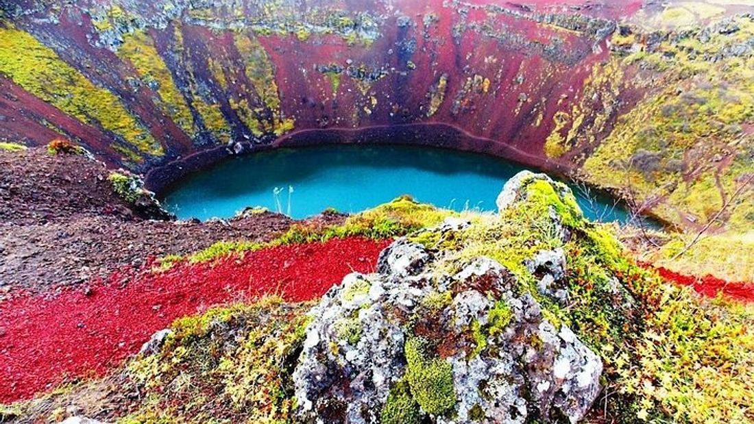
The walls are the cone's own scoria, which is why the colour is so consistent all the way round.
Why the Rock Is Red
The colour is chemistry rather than mineral pigment, and it happens fast.
The wall material is scoria, a light, bubbly volcanic rock full of gas cavities, thrown out as fragments during the eruption and piled up around the vent.
Icelandic basalt is iron-rich. When the hot fragments meet air, the iron in them oxidises, which is rusting on a geological scale rather than a chemical one.
That produces the rust-red and orange that dominates the bowl. Where oxidation was incomplete, the rock stays closer to black, which is why the walls are banded rather than uniform.
Moss and low vegetation have colonised the gentler slopes over six thousand years, so the green comes and goes with the season while the red stays.
Light changes the effect considerably. Overcast flattens the red towards brown, while low sun in the evening makes the whole bowl glow.
The Lake at the Bottom
Not a rain pool, which is the common assumption and the wrong one.
The lake sits at the local water table. The crater floor cut below the level of the groundwater in the surrounding lava field, so water seeps in from the sides rather than falling in from above.
That means the level rises and falls with the groundwater rather than with recent rainfall. Depth varies between about 7 and 14 metres through the year.
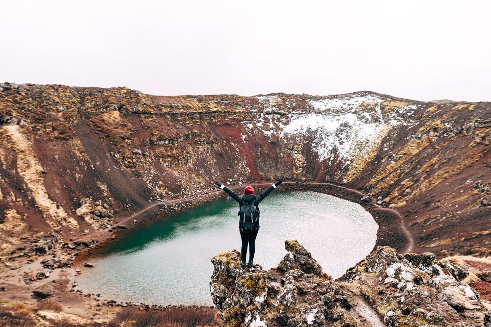
The colour is a product of the water depth, the minerals dissolved in it and the red walls reflecting into it. On a bright day it reads aquamarine, and on a grey one it reads slate.
Nothing much lives in it. The water is mineral-rich and the crater is steep-sided, so there is little for a food chain to start from.
Swimming is not permitted, and the water is cold enough year-round to make that an easy rule to follow.
How Deep and How Big
The numbers, because they are more useful than adjectives.
Depth from rim to water is about 55 metres, which is a fifteen-storey building.
The crater is 270 metres along its long axis and 170 metres across the short one, which is where the oval shape shows.
Water depth runs between 7 and 14 metres depending on the season.
The rim loop is around 20 minutes at a walking pace, and the stairway down to the shore has roughly 200 steps.
Our page on Kerið crater covers the practical side, including the 700 ISK entrance fee.
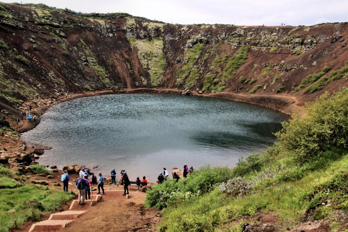
From the rim you can read the banding in the walls, which records how the cone was built.
Reading the Geology From the Rim
Four things to look for, none of which need equipment.
Look at the banding in the walls. Alternating red and darker layers record successive falls of scoria during the eruption, each one oxidised to a different degree.
Look at the slope angle. The inner walls sit close to the angle of repose for loose scoria, which is what you get when material collapses rather than being cut by water.
Look at the shape from the eastern high point. The oval, and the way the long axis lines up with the other craters in the row, is only obvious from up there.
Look at the vegetation line. Moss has taken the gentler south-facing slopes and left the steep north-facing walls bare, which shows you where material is still moving.
The best single viewpoint for understanding the whole structure is the northern rim looking south, which puts the lake in the middle and the row of craters behind you.
How Kerid Compares to the Rest of the Golden Circle
The route is a short course in Icelandic geology, and Kerið is the volcanic chapter.
Þingvellir is the plate boundary, where the crust is pulling apart and the rift valley has dropped between two walls. Our guide to walking between two continents covers it in detail.
Geysir is the heat, where groundwater meets a shallow magma system and Strokkur turns that into an eruption every five to ten minutes.
Gullfoss is the erosion, where a glacial river undercuts hard rock and retreats upstream, as our piece on how Gullfoss was formed sets out.
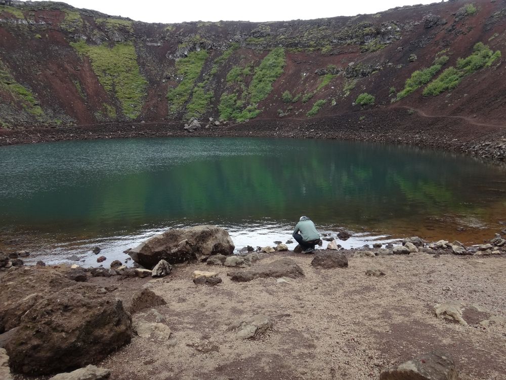
Kerið is the eruption itself, and the only stop on the loop where you are standing inside a volcano rather than beside its effects.
All four sit within an hour of each other because the volcanic zone runs diagonally across this part of the country.
Seeing It Yourself
Straightforward, and better with a little planning.
Kerið is on Route 35 between Selfoss and Reykholt, about 50 minutes from Gullfoss and an hour from Reykjavík.
Entry is 700 ISK per person and parking is free. Allow 30 to 45 minutes for the rim loop and the descent.
Midday light gives the strongest colour in the water, and low evening sun gives the best colour in the rock. You cannot have both.
Friðheimar tomato farm is 20 minutes away and makes the obvious lunch pairing, and our page on Friðheimar covers the booking.
The rim path is loose gravel, so proper shoes matter, and traction spikes are worth having between November and April.
Weather at the site is exposed on all sides. At Hjarðarland, the nearest long-running station to the route, Met Office climate data puts July's mean wind at 3.4 metres per second, the calmest month of the year, which tells you what the other eleven are like.
Stand Inside a Volcano on a Golden Circle Day
Kerið takes 45 minutes and it is the only stop on the route where you are inside the thing rather than looking at it. Our small-group Golden Circle tour with Kerið and Friðheimar includes the entrance fee, keeps groups under twenty and gives you time to walk the rim and go down to the water. Tell us your dates and we will find you a departure.
Compare Golden Circle Tours
Check each selected product for its current operator, guide, itinerary, meeting point, and terms.
View Our Tours

